Showing posts with label Stormchase 2011. Show all posts
Showing posts with label Stormchase 2011. Show all posts
Tuesday, November 8, 2011
Video of Alden and Ft. Cobb, OK Tornadoes 11/07/2011
Close approach to the Alden tornado:
Video clip of Ft. Cobb Tornado:
Chase Data:

SW to C Oklahoma Autumn Tornadoes 11/07/2011
Eric Sipes and I left Cordell at approximately 9:30 am for Will Rogers Airport to pick up Ben McMillan who was flying in to join with us on the chase. Our morning target was the Vernon, TX to Altus, OK to Snyder, OK triangle, a target that verified even though we didn't end up there.
After picking Ben up we blasted down I-44 toward Lawton with the intention of heading W from there. However, after checking data on the way, we felt it might be better to head for a more northern target (around Hobart) with the option of heading south toward our original planned target. As we approached Hobart a storm went tornado warned near the TX border to the WSW of Hobart and a couple more had developed near Altus moving NE so we felt our target had verified although we kept an eye on the storm just S of the Red River on radar. After aborting an intercept of the western storm which was rapidly weakening we noted some rotation on the storm just W of Hobart. We pulled off and observed this funnel cloud with weak, intermittent ground circulation at 3:03-3:05 Pm CST.

After picking Ben up we blasted down I-44 toward Lawton with the intention of heading W from there. However, after checking data on the way, we felt it might be better to head for a more northern target (around Hobart) with the option of heading south toward our original planned target. As we approached Hobart a storm went tornado warned near the TX border to the WSW of Hobart and a couple more had developed near Altus moving NE so we felt our target had verified although we kept an eye on the storm just S of the Red River on radar. After aborting an intercept of the western storm which was rapidly weakening we noted some rotation on the storm just W of Hobart. We pulled off and observed this funnel cloud with weak, intermittent ground circulation at 3:03-3:05 Pm CST.

Saturday, October 8, 2011
Fall Chase in SW Kansas 10/07/2011
Set out from Cordell about 1 pm for my initial target near Liberal, KS. As I neared Liberal shortly before 5pm CDT an agitated cu field was evident SW of Turpin, OK. I filled up with fuel in Liberal and headed N on US 83 a few miles and pulled off on a county road intersection to observe. Before long a storm began to form, although it took awhile. I eventually set up at the US 83/160 junction.
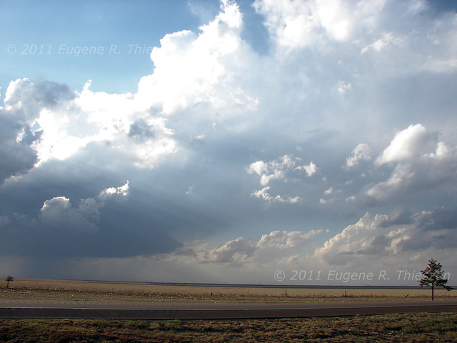 |
| Highly-sheared developing storm at 5:30 pm CDT |
Sunday, September 18, 2011
NW/NC Oklahoma 09/17/2011
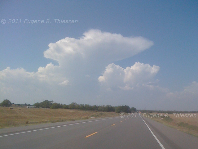
Set out from Cordell about 1 pm for my initial target of Woodward near the low. A band of towering cu in the extreme NE TX panhandle became evident while I was on the way:
Tuesday, May 24, 2011
Monday, May 9, 2011
SC/SW Oklahoma High-based Severe Storms 05/08/2011
Eric and Gene left Cordell at about 4:30 pm and headed out toward some cells developing in the Carnegie to Anadarko to Apache triangle in Caddo County. All of the convection was high-based and at times marginally severe. Nothing to write home about, but better than sitting at home.
High-based cell near Walters, OK:

High-based cell near Walters, OK:
Monday, April 25, 2011
Chase in Eastland County, TX 04/24/2011
Tornado-warned HP supercell along I-20 in Eastland County, TX near the town of Ranger. (Stitched Panorama) Gene was out solo on this Sunday afternoon chase.

Chase Data:
Solo Chase by Eugene Thieszen
Miles: 618
Tornadoes: 0
Tornado-warned supercells: 2
Chase Data:
Solo Chase by Eugene Thieszen
Miles: 618
Tornadoes: 0
Tornado-warned supercells: 2
Friday, April 15, 2011
NE Oklahoma Chase 04/14/2011
Two members of the WXtreme Chase Team (Walt and Gene) departed Cordell, OK late morning for an initial target in the Ponca City area. Dynamics looked even better in the SE Oklahoma area E of I-35 but we were non-plussed by the lack of road options and trees and stuck with the NE Oklahoma target...somewhat weaker dynamics, but better chase conditions.
Not long after arrival in Ponca City towering cumulus began to build on the dryline. We travelled E along HWY 60 and found a position about half the distance to Burbank to watch storms develop. Before long a storm developed just S of the highway and as it crossed the highway at 3:35 pm CDT it developed this interesting little high-based funnel:

Not long after arrival in Ponca City towering cumulus began to build on the dryline. We travelled E along HWY 60 and found a position about half the distance to Burbank to watch storms develop. Before long a storm developed just S of the highway and as it crossed the highway at 3:35 pm CDT it developed this interesting little high-based funnel:
Saturday, April 9, 2011
C-NC Oklahoma - Stick-to-it-iveness Pays Off After Dark 04/08/2011
The WXtreme Chase Team assembled in Cordell, OK and headed out toward a very tentative initial target of Hinton, OK to set themselves up ENE of towering cumulus on a dryline that was slowly mixing east. As the cumulus eroded from the south, the team drifted north and eventually reached Watonga. As more towers continued to go up, a storm eventually became rooted to the NW of Watonga just before 6:00 pm CDT:

Subscribe to:
Posts (Atom)