 ">
">Thursday, May 20, 2010
Western/South Central Oklahoma Tornadoes 05/19/2010
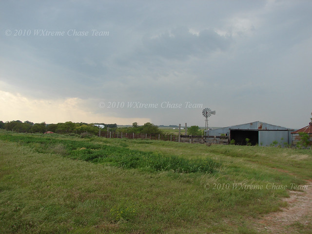
The WXtreme Chase Team began the day in Cordell and moved on toward Sayre when towering cu began to show up on satellite just across the border in the Texas panhandle. After watching some towers attempt to go up, we moved back east to Elk City and headed north on SR 33 to intercept a storm developing near Arnett. We set up about a mile W of 33 on SR 47 south of Leedey to watch the storm develop.
">
">Wednesday, May 19, 2010
May 19th Chase Prospects
Storm chase prospects look good for the local area today. Cordell is a good place to start and the WXtreme Chase Team can adjust from there as more data comes in and the weather scenario develops.
Tuesday, May 11, 2010
Off to the Races - NC Oklahoma High Risk Chase 05/10/2010
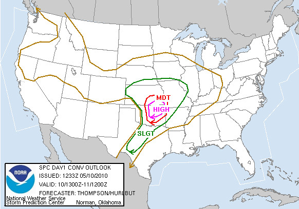
May 10 looked to be an interesting day. The forecast models and the SPC 1300 Day 1 pointed to a major severe weather outbreak in central and eastern Oklahoma, albeit the storms were forecast to be moving at 50+ mph. Not an easy chase to be sure.
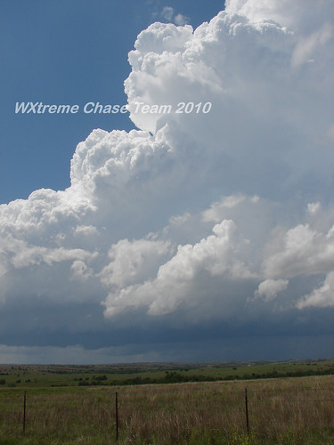
The WXtreme Chase Team gathered in Cordell and after reviewing the 12Z NAM model run and some discussion, left for Enid, OK at around mid-morning. (The area WSW of Oklahoma City looked good as well but we weren't particularly interested in chasing fast-moving storms into the metro area.) After getting lunch and checking further data we decided to re-locate just west of Pond Creek. Before long activity began along the dry-line and we decided to move west to near Carmen and wait for the storms to approach.
Here's a shot of the storm we began to focus on at abt 2:30 CDT while it was still quite a way off:
Subscribe to:
Posts (Atom)