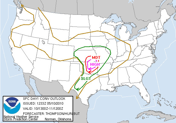
May 10 looked to be an interesting day. The forecast models and the SPC 1300 Day 1 pointed to a major severe weather outbreak in central and eastern Oklahoma, albeit the storms were forecast to be moving at 50+ mph. Not an easy chase to be sure.
The WXtreme Chase Team gathered in Cordell and after reviewing the 12Z NAM model run and some discussion, left for Enid, OK at around mid-morning. (The area WSW of Oklahoma City looked good as well but we weren't particularly interested in chasing fast-moving storms into the metro area.) After getting lunch and checking further data we decided to re-locate just west of Pond Creek. Before long activity began along the dry-line and we decided to move west to near Carmen and wait for the storms to approach.
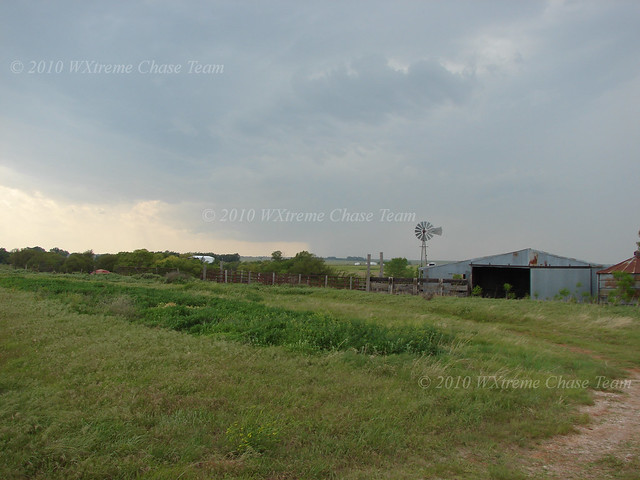
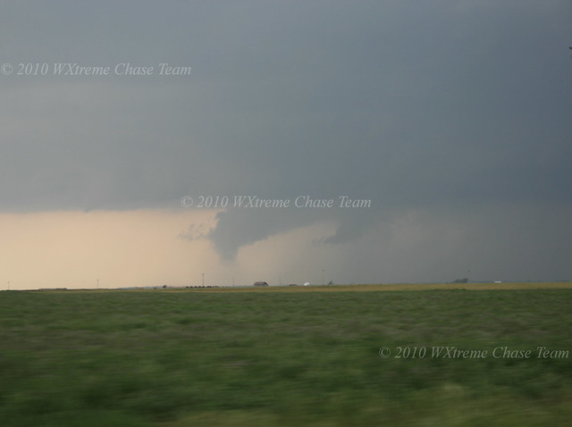
Here's a shot of the storm we began to focus on at abt 2:30 CDT while it was still quite a way off:
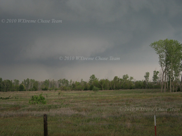
As the storm approached we re-positioned S of Carmen so we had a good easterly road option toward Helena. We wanted to be prepared for the storm to maintain its NE course or perhaps make a right turn.
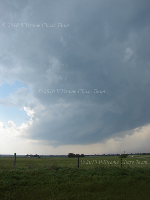
A shot near Carmen as the storm begins to organize:
We continued E with the storm as it went tornado warned and began to pick up speed. Thinking our strategy through after the chase, it might have been better to remain at a greater distance from the storm.
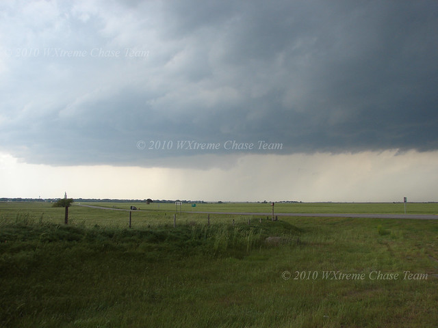
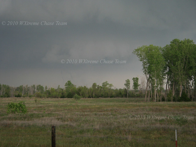
Another shot near Carmen just before the race began:
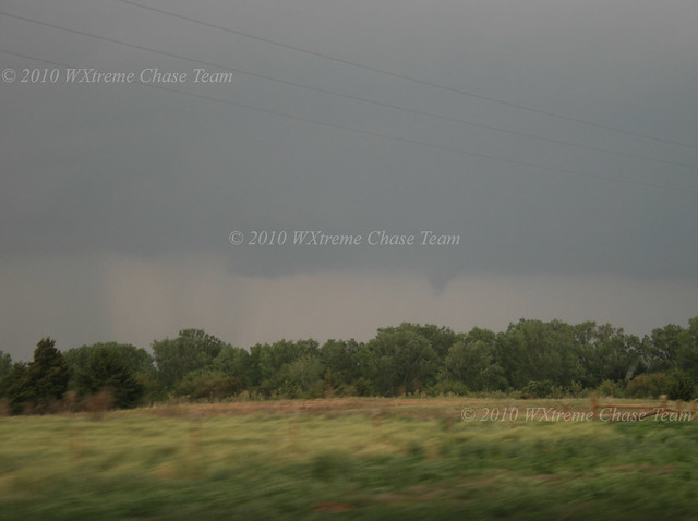
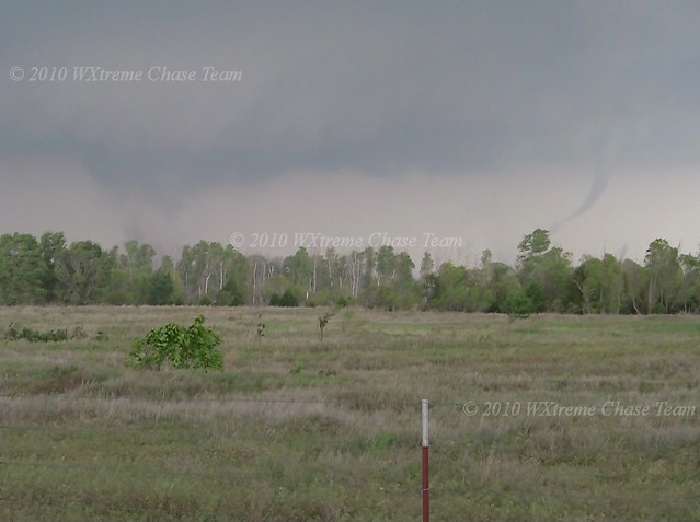
We managed to stay with the storm which continued moving NE. This rather interesting lowering developed to our W when we were just N of Nash. Perhaps a funnel...perhaps not. A little to far away to discern adequately what was going on while driving:
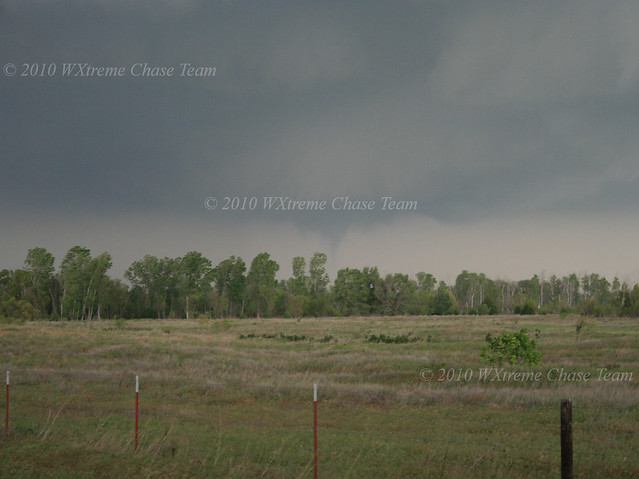
This bona-fide funnel cloud developed to our NW at about 3:35 CDT when we were perhaps 5 miles S of the SR 11 junction N of Nash. Spotters reported a tornado:
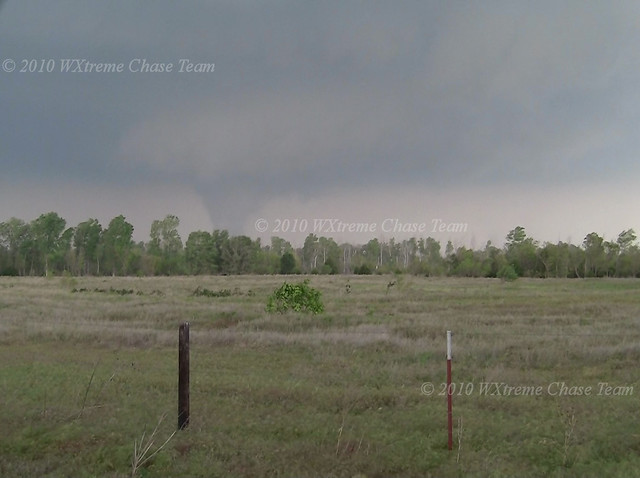
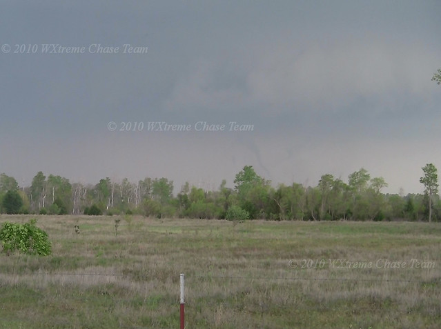
About 5-7 minutes later another tornado developed quickly just E of the road as we neared SR 11 (about 5 miles SW of Wakita) and moved off quickly to the E:
A satellite formed E of the main tornado:
It dissipated quickly and the main tornado showed off with a dance of multiple snake-like suction spots:
As the tornado moved behind the trees we back-tracked a couple of miles and headed E on a county road and then N in a vain attempt to stay with the storm. We were able to see the large tornado that developed following the first, but it was very low contrast so the pictures we took show very little.
Realizing this storm had gotten away from us, we elected to head toward I-35 and go S to meet the new storms developing quite a way further SW along the dry line. But they too were moving so fast that we could not get in position before they crossed to our E. We called the chase and returned to home base.
Chase Data:
Team Chase: Eugene Thieszen, Walt Gish and Eric Sipes
Total Miles: ~515
Tornadoes: 2 (perhaps 3)
No comments:
Post a Comment