I left Cordell about mid-morning to meet up with Walt Gish in Canyon, TX for a chase down toward the New Mexico border SW of Amarillo. The risk for severe storms was reasonable, but the tornado risk was progged as very low. However there was a remnant outflow boundary analyzed W to E across the panhandle which was forecast to lie from about Farwell to Plainview so I decided to take a chance. (For Walt the chase was more or less local).
As we worked our way down toward Farwell there were numerous storms moving N that were severe, but not tornadic. However a storm across the New Mexico border NE of Portales went tornado warned.
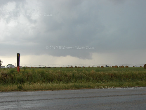
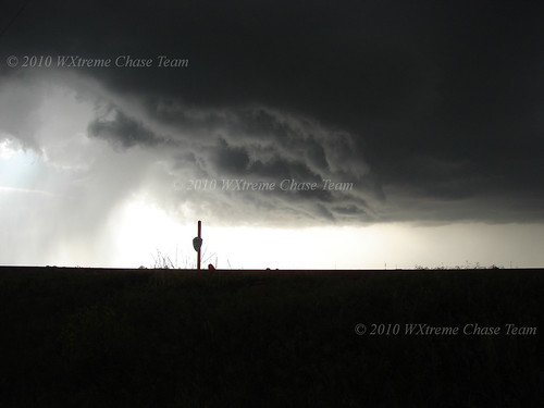
We intercepted along FM 1731 about 9 miles S of Bovina at 4:52 CDT. The storm had an obvious wall cloud but did not seem near to producing a tornado:
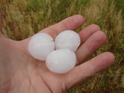
As it moved NE it left behind some quarter-sized hail:
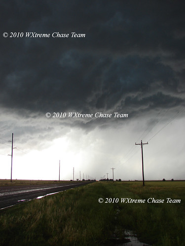
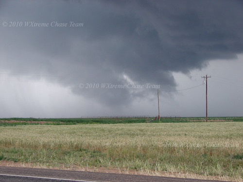
At that point, it weakened rapidly and I began to think we had miscalculated. But as the storm neared Bovina it hit the boundary and made a hard right turn and began to move E along SR 66 at about 15 mph. It slowly gained strength and showed some signs of re-organizing rotation, but the bases were relatively high:
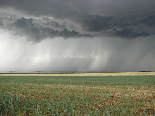
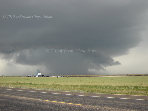
However precipitation began to increase and slowly the bases lowered. This shot was taken at about 6:00 CDT:
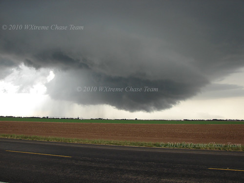
About 20 minutes later, the storm had an obvious meso just N of the road, but a tornado did not seem imminent. Low-level winds were very weak - maybe 5-7 mph.
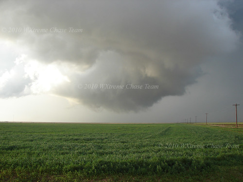
Eventually this very low, but somewhat disorganized, wall cloud developed:
The storm took on an obvious supercellular structure, but the meso was wrapped in rain. There was a lot of inflow into the rain-wrap and there may have been a weak tornado buried in there, but it was not possible to say for sure. This picture was taken at 6:55 CDT:
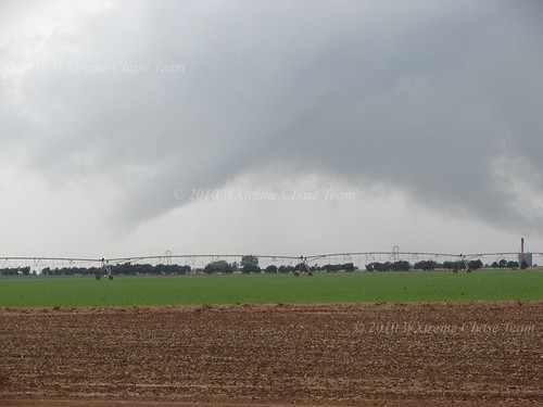
The rain slowly dissipated and the storm reorganized and produced this low hanging wall cloud with an obvious RFD slot about 15 minutes later:

20 minutes later, the storm had cycled yet again. Low and ominous, but no tornado:
As yet another meso began to occlude about 2 miles W of Dimmitt, the storm suddenly produced this funnel cloud at 7:50 CDT:
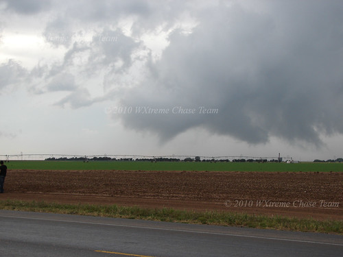
And about a minute later a tornado touched down briefly setting off the sirens in Dimmitt. The needle in the haystack has been found!
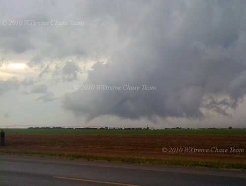
As the wall cloud fully occluded and the condensation lifted the long, stretched out tornado cyclone was visible. The tornado maintained a circulation on the ground though, until it completely dissipated.
East of Dimmitt, the storm reorganized yet again about 10 minutes later and we saw this meso and wall cloud colorfully lit by the sun. A second tornado was reported, but we believe the report was overly-eager. From our vantage point we saw only RFD with a gustnado in it:
As the storm moved slowly ENE it weakend rapidly below severe limits although as darkness fell it took on a picturesque LP structure. To bad it was too dark to take pictures!
Chase Data:
Team Chase: Eugene Thieszen and Walt Gish
Miles: ~545 (Gene)
Team Chase: Eugene Thieszen and Walt Gish
Miles: ~545 (Gene)
Tornadoes: 1 confirmed, possibly a 2nd in the rain-wrap
No comments:
Post a Comment