Saturday, September 11, 2010

Severe Storms near Wellington, KS 09/10/2010


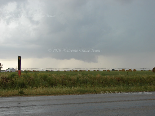
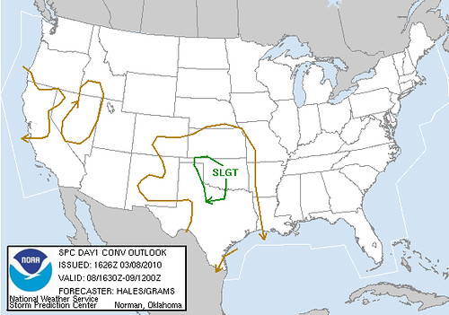
When I left Cordell for Kansas, it seemed the dynamics were present not only for severe weather, but tornado possibilities as well. As it turned out, some rotation was visible as storms developed, but they lined out very quickly. And it took until well after 7:00 pm CDT for anything to happen. So once it did, daylight was limited.

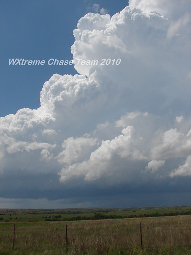
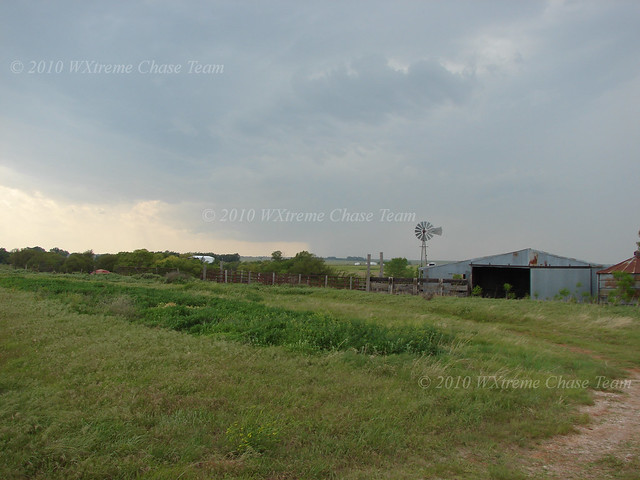
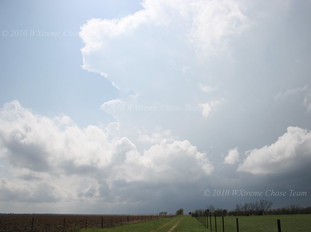
In any case here are a few pictures of the developing stages of the severe line segment near Wellington, KS

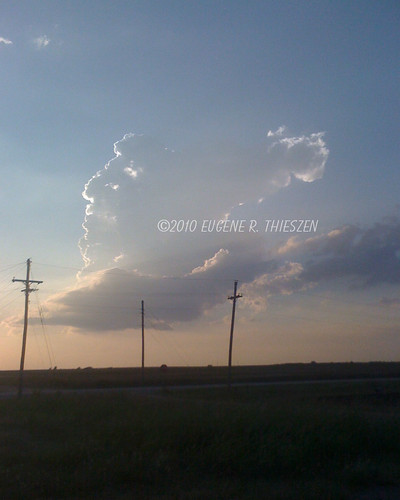
The first rather anemic tower goes up at about 7:15 pm CDT:
Wellington 1

Thursday, September 9, 2010

Possible Kansas Chase Tomorrow

Continuing to look at the possibility of and EC Kansas storm chase tomorrow. This morning's models looked pretty good...will make a final decision after tonights model run.

Saturday, August 14, 2010

W Oklahoma Hot Season Thundershower 08/13/2010


What to do on a very hot (103F) Oklahoma summer afternoon while nursing a very strong case of SDS? How about finding some of nature's own air conditioning. Left Cordell shortly after 5:00 pm and drove toward some very high-based thundershowers in the hopes of finding some gustnadoes in the outflow. Didn't find those, but I did find a big temperature drop (down to 71F); some brief, heavy rain; pea-sized hail and gusty winds. And a few pretty loud cracks of thunder! CGs were few but very hot!

Here are a few pics from E of Carter, OK:
Carter 1

Wednesday, May 26, 2010

Video of Dimmit, TX Tornado 05/25/2010

Found! The Needle in the Haystack - The Dimmitt, TX Tornado 05/25/10


I left Cordell about mid-morning to meet up with Walt Gish in Canyon, TX for a chase down toward the New Mexico border SW of Amarillo. The risk for severe storms was reasonable, but the tornado risk was progged as very low. However there was a remnant outflow boundary analyzed W to E across the panhandle which was forecast to lie from about Farwell to Plainview so I decided to take a chance. (For Walt the chase was more or less local).

As we worked our way down toward Farwell there were numerous storms moving N that were severe, but not tornadic. However a storm across the New Mexico border NE of Portales went tornado warned.

We intercepted along FM 1731 about 9 miles S of Bovina at 4:52 CDT. The storm had an obvious wall cloud but did not seem near to producing a tornado:

Dimmitt 1

Thursday, May 20, 2010

Video of Elmore City, OK Tornado 05/19/2010

Video of Leedey, OK Tornado 05/19/2010

Western/South Central Oklahoma Tornadoes 05/19/2010

The WXtreme Chase Team began the day in Cordell and moved on toward Sayre when towering cu began to show up on satellite just across the border in the Texas panhandle. After watching some towers attempt to go up, we moved back east to Elk City and headed north on SR 33 to intercept a storm developing near Arnett. We set up about a mile W of 33 on SR 47 south of Leedey to watch the storm develop.

Supercell 1">

Wednesday, May 19, 2010

May 19th Chase Prospects

Storm chase prospects look good for the local area today. Cordell is a good place to start and the WXtreme Chase Team can adjust from there as more data comes in and the weather scenario develops.

Tuesday, May 11, 2010

Video of Wakita, OK Tornado 05/10/2010

Off to the Races - NC Oklahoma High Risk Chase 05/10/2010


May 10 looked to be an interesting day.  The forecast models and the SPC 1300 Day 1 pointed to a major severe weather outbreak in central and eastern Oklahoma, albeit the storms were forecast to be moving at 50+ mph.  Not an easy chase to be sure.

1300 SPC Outlook

The WXtreme Chase Team gathered in Cordell and after reviewing the 12Z NAM model run and some discussion, left for Enid, OK at around mid-morning.  (The area WSW of Oklahoma City looked good as well but we weren't particularly interested in chasing fast-moving storms into the metro area.)  After getting lunch and checking further data we decided to re-locate just west of Pond Creek.  Before long activity began along the dry-line and we decided to move west to near Carmen and wait for the storms to approach.

Here's a shot of the storm we began to focus on at abt 2:30 CDT while it was still quite a way off:
Carmen 1

Friday, April 23, 2010

Video of Tornadoes Near Jericho and Clarendon, TX 04/22/2010

Texas Panhandle Tornadofest 04/22/2010


The WXtreme Chase team met up in Cordell, OK and departed around noon for the Clarendon, TX area.  The day's setup looked to be a classic TX Panhandle dryline day with the Caprock in the mix.  There was a secondary target further S along the Caprock in the Matador area, but at least for the middle to late part of the afternoon the northern target seemed to have better dynamics.  We set up in Hedley, TX at about 3:00 pm CDT  to wait for things to pop.  We didn't have long to wait.  By 4:15 CDT a storm had become established about 25 miles to our WSW.  We moved closer toward Clarendon not wanting to commit too early since convection was developing in more than one area.

Here is a view of the first well-established storm looking WSW from along US 287 between Hedley and Clarendon:
Clarendon 1

Tuesday, March 9, 2010

Video of Hammon, OK Tornado 03/08/2010

Part one:

Part two:


Part three:

Late Winter Surprise - The Hammon, OK Tornado 03/08/2010

This chase setup, which was very local for two members of the WXtreme Chase Team, Eric Sipes and Eugene Thieszen, was not one which would have drawn us very far from our home area. To give you an idea, this is what the 1630Z SPC Day 1 Outlook showed:
SPC SWODY1 1630

In fact rain continued for most of the morning and into the early afternoon. In its later outlook, the SPC dropped tornado possibilities altogether for Western Oklahoma. But our study of the models indicated that if some clearing could occur there was a possibility of some low-topped severe storms. By the time we left home base, there was some towering cumulus bubbling to our west near the Texas border.

We initially set up west of Elk City at the Berlin junction along along SR 6. There were some attempts at getting thunderstorms going, but nothing of note. This picture was taken looking SW at about 3:45 CST:

Hammon 1