Showing posts with label Kansas. Show all posts

Friday, May 17, 2013

Oklahoma and Kansas Severe Storms 5/8/2013

Gene and Jason both decided to chase Wednesday as reasonable parameters were in place conducive to severe storm development.  Jason left from Clinton at around 1:30 and headed towards Woodward again trusting the RAP's placement of a cell on the TX/OK border at around 2.  Gene headed south with a target of Greensburg, KS as he was visiting family in Nebraska.

The RAP continued its accuracy as a cell went up near the border and headed just south of Woodward at around 2:45.  It formed into an LP Supercell and quickly lost steam.  A new cell began to form to the south so Jason headed that way to watch it form.  The cell quickly became severe warned and took on some interesting features.

Looking east at high-based shear funnel 10 miles east of Vici

Sunday, May 20, 2012

Video of Tornado Near Varner, KS 05/19/2012


Much More Than Expected in South Central Kansas 05/19/2012

Chasing is always full of surprises.  Sometimes we head out to a target with hopes of a significant event only to get sunburned in a cap bust.  And sometimes we head out prompted by a bad case of Supercell Deprivation Syndrome (SDS) on what looks to be a probably waste of gas, only to be caught off guard by what we find.  Saturday May 19th, 2012 was such a day.

Gene and Jason Caster met up in Cordell, OK and headed out at about 11:30 am for an initial staging point at Pratt, KS.  As we passed Medicine Lodge a short line of agitated cu was visible to the NW and by the time we arrived in Pratt to fuel up and set up for the chase we had towering cu and before long some rather high-based cells which we observed for a bit from the Wal-Mart parking lot.  First good sign that this would be a memorable chase...initiation within 25 miles of our staging point.   Eventually we headed N toward St. John and then E on US 50 toward Stafford encountering a bit of penny-sized hail on the way.  We set up on an initial observing point just E of Stafford at noted that, although the storm bases were quite elevated, there was some strong cloud-level rotation as RFD cut into the storm as it moved ENE.

Deeply-cut RFD slot with all kinds of crazy motion near Stafford at 4:01 CDT:

Sunday, April 15, 2012

Kansas - Oklahoma High Risk 04/14/2012


Two members of the WXtreme Chase Team, Walt Gish and Eugene Thieszen departed Cordell at about 10:00 am for an initial staging point of Medicine Lodge, KS with a brief stop in Enid to pick up Jason Caster.  The third chase team member, Eric Sipes, traveled with John Hall and Ashley Mills for more or less the same target area.  While on the way a PDS tornado watch was issued for the target area and storms began to develop NE of Meade, KS and move toward the Bucklin area.  There were reports of some brief tornadoes with those cells.  So, instead of staging in Medicine Lodge as planned, we headed toward Coldwater to refuel and strategize.  By that time a new supercell was ongoing to the S near the Oklahoma border so we headed E along US 160 to intercept it on its NE course.  Setting up on the Aetna Road, we observed its approach.  It developed a large wall cloud and perhaps a few brief funnels, but no tornado seemed imminent.

View to the SW from Aetna Road at 3:58 CDT:

Saturday, October 8, 2011

Fall Chase in SW Kansas 10/07/2011

Set out from Cordell about 1 pm for my initial target near Liberal, KS.  As I neared Liberal shortly before 5pm CDT an agitated cu field was evident SW of Turpin, OK.  I filled up with fuel in Liberal  and headed N on US 83 a few miles and pulled off on a county road intersection to observe.  Before long a storm began to form, although it took awhile.  I eventually set up at the US 83/160 junction.
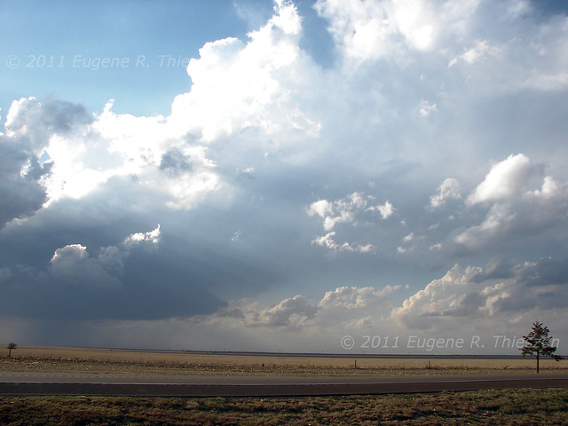
Highly-sheared developing storm at 5:30 pm CDT

Saturday, September 11, 2010

Severe Storms near Wellington, KS 09/10/2010


When I left Cordell for Kansas, it seemed the dynamics were present not only for severe weather, but tornado possibilities as well. As it turned out, some rotation was visible as storms developed, but they lined out very quickly. And it took until well after 7:00 pm CDT for anything to happen. So once it did, daylight was limited.

In any case here are a few pictures of the developing stages of the severe line segment near Wellington, KS

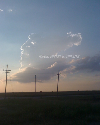
The first rather anemic tower goes up at about 7:15 pm CDT:
Wellington 1