Friday, April 23, 2010

Texas Panhandle Tornadofest 04/22/2010
The WXtreme Chase team met up in Cordell, OK and departed around noon for the Clarendon, TX area. The day's setup looked to be a classic TX Panhandle dryline day with the Caprock in the mix. There was a secondary target further S along the Caprock in the Matador area, but at least for the middle to late part of the afternoon the northern target seemed to have better dynamics. We set up in Hedley, TX at about 3:00 pm CDT to wait for things to pop. We didn't have long to wait. By 4:15 CDT a storm had become established about 25 miles to our WSW. We moved closer toward Clarendon not wanting to commit too early since convection was developing in more than one area.
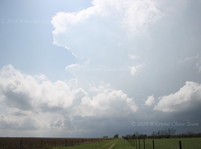
Here is a view of the first well-established storm looking WSW from along US 287 between Hedley and Clarendon:
Tuesday, March 9, 2010
Late Winter Surprise - The Hammon, OK Tornado 03/08/2010
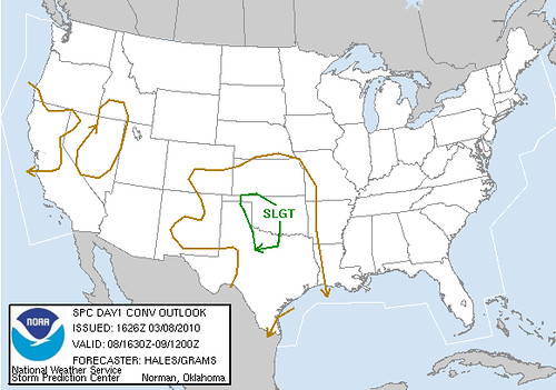
This chase setup, which was very local for two members of the WXtreme Chase Team, Eric Sipes and Eugene Thieszen, was not one which would have drawn us very far from our home area. To give you an idea, this is what the 1630Z SPC Day 1 Outlook showed:

In fact rain continued for most of the morning and into the early afternoon. In its later outlook, the SPC dropped tornado possibilities altogether for Western Oklahoma. But our study of the models indicated that if some clearing could occur there was a possibility of some low-topped severe storms. By the time we left home base, there was some towering cumulus bubbling to our west near the Texas border.
We initially set up west of Elk City at the Berlin junction along along SR 6. There were some attempts at getting thunderstorms going, but nothing of note. This picture was taken looking SW at about 3:45 CST:
Subscribe to:
Posts (Atom)