Not long after arrival in Ponca City towering cumulus began to build on the dryline. We travelled E along HWY 60 and found a position about half the distance to Burbank to watch storms develop. Before long a storm developed just S of the highway and as it crossed the highway at 3:35 pm CDT it developed this interesting little high-based funnel:
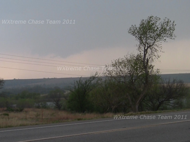
We elected to let that storm go as it continued NE and instead focused on another storm that developed along the dryline between Stillwater and Ponca City and was coming toward our position from the SW. We adjusted our position E to set up just west of Burbank and waited. The storm began to show some indications of developing rotation as it approached.
An HD video capture from 3:55 pm CDT:

Another somewhat zoomed capture from 4:00 pm CDT with a wall-cloud beginning to develop:
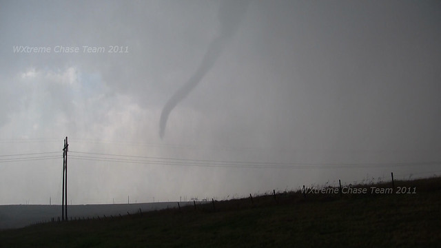
Not long after drove a couple of miles further down the road to a position ~1mile east of the SR 11/18 junction. The storm was tornado-warned at approximately 4:12 pm and within a few minutes rain curtains began to develop on HWY 60 about 1-2 miles W of our position and an evident funnel cloud became visible.
This HD video capture shows the funnel cloud beginning to extend and the rain curtains becoming more substantial at 4:16 pm:

The condensation appeared to dissipate only to re-appear about half-way down:

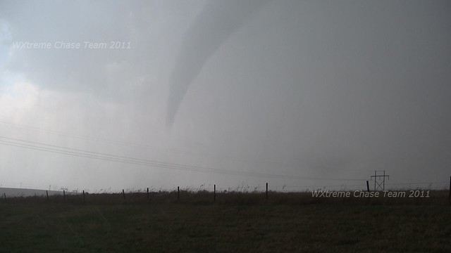
It thickened up and began to extend both upward and downward:

Eventually it became obvious that the tornado was on the ground:
The tornado at it's apparent strongest at 4:19 pm:
The tornado was visible for 5 minutes or so and then disappeared into the rain. We then headed east toward Pawhuska and and southeast down SR 11 to get in position to observe yet another storm moving toward into the Hominy/Wynona areas. At one point near Barnsdall we observed a substantial cone tornado about 7-10 miles to our SW but were unable to find a place to pull off to document it. Damage was reported along SR 99 north of Hominy. We eventually stopped just south of Wolco and observed the storm as it approached and crossed SR 11.
At 5:25 pm this rain-wrapped mesocyclone crossed near Wolco and eventually a tornado did some minor damage near Ochelata:

Road options forced us to leave the storm a bit in order to get back to it near Bartlesville. We paralleled the storm along HWY 60 up to Nowata. Some fairly significant tornado damage was reported 7 miles east of Dewey, but from our vantage point we were not able to see the tornado in the rain. East of Nowata, the storm rapidly weakened and we called off the chase.
Chase Data:
Team Chase: Eugene Thieszen and Walt Gish
Miles: 667
Tornadoes: 2
No comments:
Post a Comment