Tuesday, April 26 was a second disappointing day in NE Texas for our Chase Team - Monday wasn't too hot either! Arriving at our initial target of Greenville, TX on time and in good shape, we noted storms going up on the triple-point in Van Zandt County, but in this case our "stick to the original target" philosophy got the better of us. Every time we nearly made the decision to head south, the boundary gave indications that storms would develop as we had forecast. Case in point: a cell that developed NE of Dallas and went severe in 20 minutes. Visually it had every indication that it would become a major supercell and then proceeded to die a quick and ignominious death!
By the time we decided to take on the southern storms as it was apparent that they were eating up the moisture needed for sustained convection on the stationary front, it was very difficult to find a way through and as a result the only thing we managed was to see was a mostly rain-wrapped meso east of Minneola near Hawkins. Nothing to write home about!
But then, there is always another day and always another storm. No chaser gets it right every time! And so far NE Texas has kept our pride in check!
Gene
Wednesday, April 27, 2011
Tuesday, April 26, 2011
Chase Update
The Team and Gene (solo) have been out on several chases since the end of last week, but unfortunately there has not been much available time to update the chase logs. Will do so eventually...
Gene
Gene
Chasing Prospects for Tuesday 4/26/2011
Moderate/High risk for NE Texas. Initial target will probably be the Gainesville, TX area with adjustment from there.
Monday, April 25, 2011
Chase in Eastland County, TX 04/24/2011
Tornado-warned HP supercell along I-20 in Eastland County, TX near the town of Ranger. (Stitched Panorama) Gene was out solo on this Sunday afternoon chase.

Chase Data:
Solo Chase by Eugene Thieszen
Miles: 618
Tornadoes: 0
Tornado-warned supercells: 2
Chase Data:
Solo Chase by Eugene Thieszen
Miles: 618
Tornadoes: 0
Tornado-warned supercells: 2
Friday, April 22, 2011
Today's Chase 4/22/2011
Chasing possibilities have evolved somewhat differently than earlier forecast - further south and east. Looking to set up roughly in the Ardmore, OK area. HRRR points to a large cell in that area by 5 pm. Most recent NAM guidance suggests a line, with "tail-end charlie" near the Red River. We will see what happens. Look for us live streaming on Severe Studios later on today. (posted by Gene)
Thursday, April 21, 2011
Chasing Prospects for Friday 4/22/2011
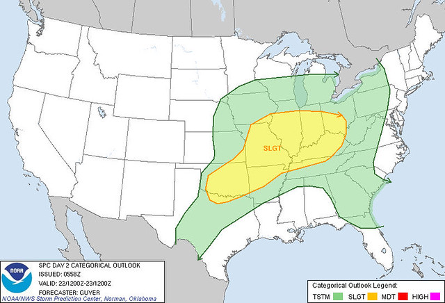
In the next four days, there appear to be a number of good chase possibilities. The actual locations and setups each day may well vary considerably from earlier forecasts as convection and storms from the day before modify the atmospheric conditions and lay down outflow boundaries. Rather than bore you with the details from the forecast models, here is the current SPC Day 2 Outlook for tomorrow, April 22nd which gives some sense of the possibilities:
Friday, April 15, 2011
NE Oklahoma Chase 04/14/2011
Two members of the WXtreme Chase Team (Walt and Gene) departed Cordell, OK late morning for an initial target in the Ponca City area. Dynamics looked even better in the SE Oklahoma area E of I-35 but we were non-plussed by the lack of road options and trees and stuck with the NE Oklahoma target...somewhat weaker dynamics, but better chase conditions.
Not long after arrival in Ponca City towering cumulus began to build on the dryline. We travelled E along HWY 60 and found a position about half the distance to Burbank to watch storms develop. Before long a storm developed just S of the highway and as it crossed the highway at 3:35 pm CDT it developed this interesting little high-based funnel:
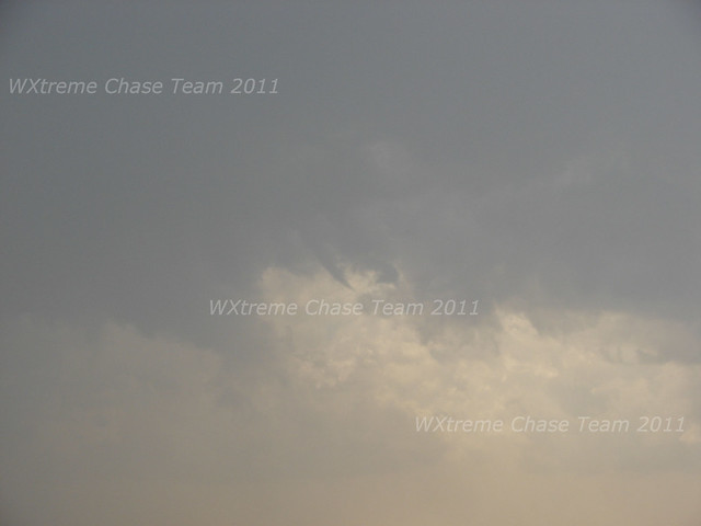
Not long after arrival in Ponca City towering cumulus began to build on the dryline. We travelled E along HWY 60 and found a position about half the distance to Burbank to watch storms develop. Before long a storm developed just S of the highway and as it crossed the highway at 3:35 pm CDT it developed this interesting little high-based funnel:
Sunday, April 10, 2011
NW Oklahoma/SC Kansas 04/09/2011
Chase Log Coming...
Chase Data:
Team Chase: Eugene Thieszen, Walt Gish, Eric Sipes
Miles: 376
Tornadoes: 0
Saturday, April 9, 2011
C-NC Oklahoma - Stick-to-it-iveness Pays Off After Dark 04/08/2011
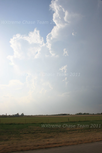
The WXtreme Chase Team assembled in Cordell, OK and headed out toward a very tentative initial target of Hinton, OK to set themselves up ENE of towering cumulus on a dryline that was slowly mixing east. As the cumulus eroded from the south, the team drifted north and eventually reached Watonga. As more towers continued to go up, a storm eventually became rooted to the NW of Watonga just before 6:00 pm CDT:
Monday, April 4, 2011
SE Kansas 04/03/2011
Chase Log coming...
Chase Data:
Team Chase: Eugene Thieszen, Walt Gish and Eric Sipes
Miles: 660
Tornadoes: 0
Subscribe to:
Comments (Atom)